

Indigenous Peoples Atlas of Canada

توضیحات Indigenous Peoples Atlas of Canada
The Indigenous Peoples Atlas of Canada, produced by The Royal Canadian Geographical Society in partnership with the Assembly of First Nations, Inuit Tapiriit Kanatami, the Métis Nation, the National Centre for Truth and Reconciliation and Indspire, the Indigenous Peoples Atlas of Canada shares the stories, perspectives, voices and history of the Indigenous Peoples of Canada. It includes historic and contemporary maps and explores themes of language, demographics, economy and culture. Important topics such as treaties and residential schools are covered in-depth, as well as the contributions of Indigenous Peoples, their oral traditions and land-based knowledge.
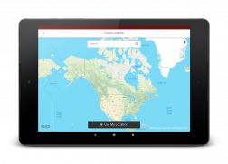
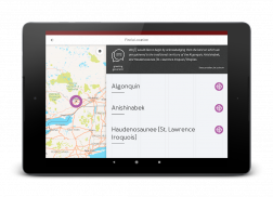
A territorial or land acknowledgment is a centuries-old tradition among Indigenous Peoples, and is also today an important part of Canada's reconciliation process — it is becoming common for non-Indigenous people to make such acknowledgments at public events and in schools.
بومی مردم اطلس کانادا، تولید شده توسط انجمن جغرافیایی سلطنتی کانادا در همکاری با مجلس به سازمان ملل اول، اینویت Tapiriit Kanatami از متیس ملت، مرکز ملی حقیقت و آشتی و Indspire از مردم بومی اطلس کانادا سهام داستان ، دیدگاه ها، صداها و تاریخ بومیان کانادا است. این شامل نقشه های تاریخی و معاصر و به بررسی تم زبان، جمعیت، اقتصاد و فرهنگ است. موضوعات مهم از قبیل معاهدات و مدارس مسکونی در عمق پوشیده شده، و همچنین به عنوان سهم مردم بومی، سنت شفاهی و دانش مبتنی بر زمین.
اذعان ارضی و یا زمین سنت صد ساله در میان مردم بومی است و بخش مهمی از روند آشتی کانادا است نیز امروز - آن است که رواج برای افراد غیر بومی به چنین قدردانی در رویدادهای عمومی و در مدارس.


